Feel like it’s time you headed for the hills? Kate Preece proves a day walk is within reach for even the most sedentary among us.
Somewhere between Covid-19 outbreaks came a time a five-hour Mt Somers walk sounded like a good idea.
The WhatsApp group was duly formed and the instructions shared. Six great girlfriends, who normally convened for gin, would start walking at 10am, equipped with a packed lunch, drink bottle, extra layers and toilet roll, and be back at the cars by 4pm at the latest. What could possibly go wrong?
I am not a hiker. Had it not been for lockdown, I would not have classed myself as much of a walker either. However, my friend Eila had recently walked the Mt Somers Track to Woolshed Creek Hut, retracing steps from when she was young and, while there were a couple of uphill bits, she said the two-and-a-half-hour walk to the hut wouldn’t be beyond us.
In fact, the return walk from the Jig Road car park (10km from the Mt Somers township) to the hut is described by the Department of Conservation as suitable for children. And we did meet a family along the way. We thought they were crazy (we had left ours behind), but it certainly motivated us to keep moving. The thought of being overtaken by toddlers was mortifying.
 With sweeping views of Ashburton Gorge and Alford Forest and an ever-changing landscape as we crossed through both open country and rich forest, the vista was impressive. Time seemed to fly by as the chatter carried on down the line, which was mostly single file but switching in order, as different members of our newbie walking party paused for a drink or to simply soak in the surroundings.
The highest point gave us a clear view down to the hut, our lunch spot, as a cheeky snowball flew through the air.
Impressed by the standard of the hut (complete with 26 bunks) and its amenities (clean long drops), we unpacked our various lunches – from borrowed children’s lunchboxes – and watched as two, more serious-looking hikers with poles and packs, emerged from the opposite direction.
It wasn’t the first time the two Brazilians had been to this hut, and they were soon keenly sharing photos of our surroundings coated with last winter’s snow. They had walked in from the Staveley car park, past the other shared accommodation option, the Pinnacles Hut.
It was in that direction a swing bridge beckoned. We packed up and rock-hopped across the narrow creek to see it up close.
Before reaching it, a couple emerged. They had followed an alternative trail that also led back to our starting point.
“It’s a steep uphill climb for the first hour, but then it’s flat,” he said. The pair looked about as prepared as we were and what would be downhill for us sounded easy enough, so we decided to follow in their footsteps instead of backtracking on ours.
We crossed the single-person swing bridge spanning a spectacular gorge, high enough to give some the jitters.

The Brazilian friends caught us up, concern on their faces.
“Make sure you turn off at the bus stop.”
Confident in what had so far been a very well-marked, well-trodden track, we nodded our heads and brushed off the peculiarity of what they had said.
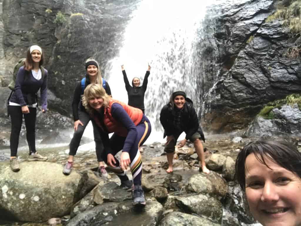
The other hikers had mentioned a waterfall detour that was well worth taking and it was due to this golden insider information we chanced upon Mother Nature in all her glory.
The water ran thick and fast in relentless cascades, blocking our ears with its roar. Blasts of polar-cold air came at us in waves and the spray of water bouncing off the rock face was a source of new energy. It was the highlight of my day and the type of city contrast that makes such an adventure all the more fulfilling.
We continued up and up. Our most intense and longest climb, it was 500m to an 1143m pinnacle along the Mt Somers Track’s south face.
Between pauses to ease searing legs, we were acutely aware we still needed to find a ‘bus stop’.
Not a turn-off at all, the ‘bus stop’ proved to be a rocky overhang (thanks Google), a steady trail of fluorescent markers dotting the way to it across the steep mountainside and beyond.
It became a little less glamorous as the kilometres wore on. The eventual plateau proved uninspiring, its flatness just flat – no comparison to the dramatic landscapes we had scaled, from rocky steps that required both hands and feet to keep steady to winding trails through cold beech forest scented by honeydew.
The last hour down the Rhyolite Ridge Track taught us downhill could be as taxing as uphill and it was suddenly every woman for herself.
But, we made it.
Back at our friend’s home in Glentunnel, we sat on the floor, in various yoga positions, flicking through photos of what we had achieved.
We felt like champions.
As we sipped on our gins, I realised just how much ground we’d covered – and not just literally. On a walk such as this, you’re seldom out of breath and always with a friend nearby. It was such a good way to have a decent catch-up, we had the chance to cover more topics than our busy lifestyles would normally allow.
We now know what’s out there and are keen to repeat the experience, somewhere new, sometime soon. With this challenge under our belts, we can do anything.
Lessons from a first-timer
- Don’t make significant deviations from your planned path. We followed known Department of Conservation routes. It is important for people at home to know what you are doing, and when you are expected home.
- Do your research. Forewarned is forearmed! Be aware of the track’s skill level and approximate walking times.
- Take a map. Technology won’t necessarily be available when you need it.
- Know what the weather is expected to do. We would not have been smiling if we had to complete the last few hours in the rain.
- Carry a First-Aid kit within your group.
- Take more water than you think you’ll need. Yes, it will add to the weight of your daypack, but you need at least two drink bottles.
- Snacks are good. Sustenance will get you through that last hour, when your legs are over it. A bit of chocolate will lift your spirits.
- Layers are important. During our walk, I went down to a singlet at one point; full hat, jacket and gloves at another.
- Footwear is important too. You don’t have to spend a lot, but make sure the shoe is up to the task. A trail or hiking shoe will be rigid, with extra ankle support should you want it, and is designed for this purpose. A trail running shoe will have more flexibility and could see you walking off-road, rather than just up the mountainside.
- Be prepared for the wet. We ended up crossing a small creek, with most taking off their shoes to do so. A small towel would have been handy.
- Throw in toilet paper and hand sanitiser. We had toilets everywhere we went, but I could’ve done with the hand sanitiser for a quick wash when the taps didn’t run at the hut.
- Find yourself an easy track and just get out there and do it. If the toddlers can do it, so can you! You will feel much better for it.
Know before you go
Use NZTopo50 map sheets BX19 and BX20.
Before you go into the outdoors, tell someone your plans and leave a date to raise the alarm if you haven't returned. To do this, use the New Zealand Outdoors Intentions process (external site) on the AdventureSmart website. It is endorsed by New Zealand's search and rescue agencies and provides three simple options to tell someone you trust the details about your trip.